Journey to the Deep
Aug. 1, 2010
The Search for Le Griffon: Underwater explorers seek shipwrecks and other treasures in Northern Michigan watersBy Erin Crowell
Somewhere in the Great Lakes lies the answer to a question that has been on the minds of archeologists, historians and sailors for centuries:
What happened to Le Griffon? -- the French sailing ship that left Washington Harbor, near Green Bay, Wisconsin on September 18, 1679, but never reached its destination in Niagra Falls. Built by Rene-Robert Sieur de La Salle, the ship was the first European-owned vessel to sail the upper Great Lakes. Used as a fur trading ship to help supplement La Salle’s search for the mouth of the Mississippi River, the ship and its crew of six was on its return voyage to its home harbor when it disappeared.
What happened to Le Griffon?—a time capsule that many consider, when found, could reveal much about our country’s history—has been an unanswered question for the past 331 years.
That question may be answered soon.
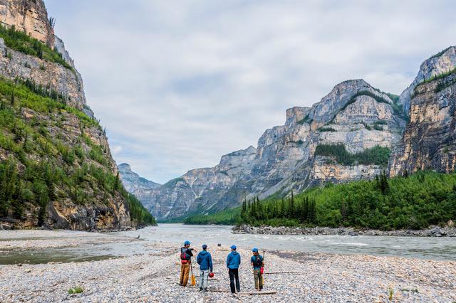
On July 19, The Great Lakes Exploration Group (GLEG) announced an agreement for cooperation between itself, the State of Michigan and the Republic of France to pursue an archeological site assessment of what could potentially be the wreckage of Le Griffon in the waters of Lake Michigan, located 80 miles out from Pine River Point in Charlevoix.
If confirmed as the long-lost French vessel, it would be, as stated by the GLEG, “a find of tremendous historical significance.” The Holy Grail of Great Lakes shipwrecks.
UNDERWATER PRESERVE
It’s one of an estimated 3,000 shipwrecks in Lake Michigan—with three times as many in the Great Lakes—that serves as a missing piece to the puzzle of our history.
“Finding a shipwreck is like going through your home and seeing that puzzle piece on the floor,” says Eric Niezgoda, vice president of the Grand Traverse Bay Underwater Preserve (GTBUP). “You pick it up and wonder which puzzle it belongs to. You put it together and say, ‘Oh, so there’s the big picture.”
Niezgoda believes knowing what’s below our waters is a way of understanding history—and like the GLEG—the preserve’s goal is to separate fact from fiction, the truth from legend.
“That’s what we’re trying to do,” he explains of the Underwater Preserve.
“Rediscovery is a good way to put it,” adds the Preserve’s president Chris Doyal. “There are so many generations that may know about a shipwreck. They just don’t know the story behind it.”
The Preserve’s primary mission is to do a complete inventory of Grand Traverse Bay. Since its inception in 2008, the Preserve has yet to cover even 10 percent of the 200 square miles of water.
“That’s just a ballpark guess,” says Doyal. “ There are deep spots which require special equipment and money we don’t have.”
“It’s just a huge, huge area,” adds Dr. Mark Holley, underwater archeologist for the project. “It’ll take us 80 or 90 years to cover the whole thing. We’re just scratching the surface.”
WHAT WE KNOW
So far, the preserve has only documented sites already known to the community, mainly on the south end of the bay.
These include the popular recreational snorkeling areas, like Haserot Beach (i.e. the “junk pile”), home to sunken cars, boats and other items from the 1950s; the wreck of “The Tramp,” a 54-foot tug built in 1926, located near Power Island; and the recently discovered prehistoric boulder with what appears to be a mastodon carving, located in a secret location of Grand Traverse Bay.
“I think it’s interesting to know a bit more about what’s down there, like ‘when exactly did that boat go down?’” says Michelle Socha of Traverse City, who has been recreational snorkeling around Grand Traverse Bay since the 1980s.
“There’s some cool stuff out there,” she says.
Take, for example, the remains of a late 1800s horse carriage that had fallen through the ice near a private beach; or the sunken barge, recently discovered over Memorial Weekend, off the shores of Elk Rapids.
“The community is where we get the little nuggets of info,” says Niezgoda. “We would have no idea of some of these things that were out there. (Residents) provide the ‘urban legends’ and stories, the pieces of verbal history that are being told. We just help to substantiate it.”
While the Underwater Preserve has no direct involvement in GLEG’s “Griffon” project, Greg MacMaster, the preserve’s former president—who, along with former Scuba North owner Jack Spencer, was the brains behind its creation—provided his own expertise to GLEG president and the diver who discovered the wreck, Steve Libert.
MacMaster, a forensic meteorologist, spent considerable time researching the weather patterns—the mixture between water and air—during the time period the Griffon disappeared. That little nugget of information gave Libert a general idea of where to dive.
A LIFETIME ENDEAVOR
Rewind to the summer of 2001. Libert was diving the Lake Michigan waters alone at a location MacMaster concluded to be a viable option of finding Le Griffon had it, in theory, gone down in a nautical storm. Libert’s vision was limited to just three inches in the murky water. It was one of hundreds of dives he had taken since he started his search – a quest that started many years ago.
“I’ve been looking for (Le Griffon) ever since I was in junior high, when my history teacher talked about La Salle and the mystery of his ship’s disappearance,” recalls Libert, who lives in Virginia but owns a vacation condo with his wife in Charlevoix. “I’ve spent the last 30-some years looking for it.”
It’s possible that a lifetime of searching came down to three inches that day.
Libert was nearing the end of his dive when he bumped into something, literally.
“It was like running into a telephone pole in the water,” he says. “It just seemed so out of place. I was sort of in shock.”
That something appeared to be the bowsprit of a wooden ship, with the rest of it buried beneath the silt, sand and zebra mussels.
Libert was running low on oxygen, but sheer excitement masked the burning sensation in his lungs.
“I tied off the spar and headed for the surface. It’s scary thinking about it now, because I surfaced the last 15 feet without air. I actually became sick from it, but I was just too excited about this new discovery to even care.”
Libert and his team marked the location, taking multiple GPS positions to ensure they didn’t lose the find.
BUILDING THE PUZZLE
From there, it was a matter of putting the pieces together. Libert assembled a team of divers, archeologists and scientists to help in identifying the wreck.
Thankfully for the tight-knit community of underwater professionals, Libert didn’t have to look very long (or far) to find an archeologist.
With connections to the Center for Maritime Underwater Resource Management, he found Dr. Holley, who also serves as head of the underwater archeology department at Northwestern Michigan College.
For the mystery ship project, the team used an MS-1000 Scanning Sonar – which can identify and inventory all objects on the lake or ocean floor.
“Using traditional methods (of underwater archeology), like side scans, can give you a general idea of whatever is down there,” says Brian Abbott of Nautilus Marine Group International, located in Haslett, Michigan. “Then you dive, measure and take pictures, which can sometimes take years. Using this technology, I can do it in a matter of hours.”
The scanning sonar technology is being used by students of the Underwater Archeology Field School, offered by Northwestern Michigan College with GTBUP instructors to guide them – including Dr. Holley. The field school is taught in the curriculum of the Nautical Archeological Society (in Britain), with the Grand Traverse Preserve as they’re training field.
The scanning sonar technology isn’t new, however the use for it has been revolutionary.
“I’m the only one in the world, who I know of, that started using scanning sonar for underwater archeology,” says Abbott.
SONIC PHOTOS
Normally used for architectural purposes on oil rigs, bridges and other structures, scanning sonar was first introduced to underwater archeology by Abbott, with one of its first uses in the Grand Traverse Bay Preserve.
When placed on the lake floor, the scanning sonar sends an acoustic pulse through the water, producing detailed images of the items below the sand and silt.
“Now we can look at real-like photos of a wreck without disturbing anything,” says Holley.
Doyal, Holley and Abbott—along with several students in the underwater archeology field school—have since used the scanning sonar on underwater sites all over the world.
“We recently just returned from a survey of the oldest underwater city in the world, located near Greece,” says Doyal.
According to Abbott, one of the best traits of using the technology is its convenience.
“We place it on a tripod and lower it by a cable to the lake bottom,” he explains.
“You don’t even have to go in the water, which is great because I’m getting too old and fat to do this, so it’s a nice toy that keeps me in the game.”
UNDERWATER POLITICS
So far, the GLEG has only taken sonar scans, along with carbon-dating tests used from samples of the bowsprit conducted by Beta Analytic Laboratories of Miami and the University of Arizona – which reported back that “Unfortunately, dates in this period using this technique are somewhat ambiguous… however, the data from the C14 analysis doesn’t preclude the possibility that what may be the bowsprit is of sufficient age to be the Griffon.”
Sonar scans have also returned fairly detailed images of what is below the sand, says Libert. However, the team remains quiet about what exactly they’ve found so far. Mainly due to the long, drawn out legal battle with the state of Michigan.
The next step in determining if the wreck is, in fact, the Griffon is text excavating.
However, because of the Abandoned Shipwreck Act, passed in 1987, the state had claimed ownership of the bottomlands of Lake Michigan; and with it, the mystery shipwreck.
Finally, after six years of debate, an agreement has been reached between the State of Michigan, the Republic of France and the GLEG, a historic event in and of itself.
With Libert inking the last required signature of the public-private partnership, it’s now just a matter of finalization through the state.
A July 19 press release issued by GLEG stated “under the terms of the new agreement, Great Lakes Exploration will partner with the Center for Maritime Underwater Resource Management (CMURM), in the archeological site assessment.
The U.S. District Court for the Western District of Michigan will continue to provide protection to the site.”
If all goes well, Libert says he anticipates a test excavation of the site no later than next spring.
What does he hope to find?
“Well, it was rumored that Le Griffon had cannons aboard,” says Libert. “If that’s true, there should be an insignia of King Louis XIV on each one. That’s a sure-fire way to know it’s the Griffon.”
For updates on the Great Lakes Exploration Group and their search for “Le Griffon,” visit www.greatlakesexploration.org. More information on the Grand Traverse Bay Underwater Preserve and how to get involved in the NMC Underwater Archeology School may be found at go to www.gtbup.org.


Trending

The Valleys and Hills of Doon Brae
Whether you’re a single-digit handicap or a duffer who doesn’t know a mashie from a niblick, there’s a n... Read More >>
The Garden Theater’s Green Energy Roof
In 2018, Garden Theater owners Rick and Jennie Schmitt and Blake and Marci Brooks looked into installing solar panels on t... Read More >>
Earth Day Up North
Happy Earth Day! If you want to celebrate our favorite planet, here are a few activities happening around the North. On Ap... Read More >>