A Bridge Runs Through It -- Mike Dillenbeck is at the Eye of the Storm with the Hartman-Hammond Bridge
May 1, 2002
Nothing has stirred up so much controversy in recent years as the proposed Hartman-Hammond project in Traverse City -- a plan that would link Hartman and Hammond roads by
building a bridge over the Boardman River, north of the existing one-lane Cass Road bridge.
Under the plan, Hartman Road west of the Boardman River would be realigned
and widened to a four-lane boulevard between Cass Road and U.S. 31 South. A bridge would be
constructed over the river to connect Hartman and Hammond roads, and Hammond would be
widened to four lanes to LaFranier Road east of the river. The project entails about 2.25 miles.
Related work includes widening Three Mile Road to five lanes from U.S. 31 North to
South Airport Road, and possibly reconstructing Four Mile Road, if funds are available. Once the new bridge is completed, the existing Cass Road bridge would be closed to vehicles.
The plan appears to be a done deal, since the Federal Highway Administration endorsed
the project with a “record of decision“ on August 9, 2001. This allows the Road Commission to
move forward with preliminary designs, display plans to the public, and acquire right-of-ways.
Construction could start by spring of 2003 and take one to two years to complete.
But environmentalists say the road would devastate one of the last unspoiled
treasures near Traverse City. They claim the road will encourage sprawl, fail to solve regional traffic problems, threaten the safety of children at Sabin Elementary School, destroy vital wetlands and wildlife habitat, and degrade the county Nature Education Reserve.
They also say the project fails to incorporate the “Smart Roads“ plan, developed by local
citizens‘ groups to improve existing roads.
But the Grand Traverse County Road Commission says a road is badly needed in that area
and Hartman-Hammond is the best solution. At the eye of the storm is Mike Dillenbeck, manager of the Grand Traverse County Road Commission, who offers his take on the issue here.
NE: What is the history behind the Hartman-Hammond project?
Dillenbeck: In 1983, the Road Commission applied for repair moneys to fix the existing Cass
Road Bridge. The state refused that, and in 1988, we re-applied for the Michigan Critical Bridge Fund. They agreed that the structure was in critical deteriorated condition and needed to be replaced on the county road system. At that time, our intent was to replace the road and bridge near its current location, and we thought it would cost about $700,000.
NE: So originally, you were just planning on replacing the Cass Road Bridge?
Dillenbeck: Yes, but there were jurisdictional issues, because the Road Commission only has surface rights. Just the pavement on top belongs to the Road Commission; the hydroelectric dam and all the rest of it is owned by Grand Traverse County and is leased to Traverse City Light and Power. So we can‘t make those decisions solely on our own, because we don‘t have full control over that structure. Federal agencies also have a lot to say about hydroelectric dams, too, so there‘s many layers of bureaucracy with that.
NE: What happened at that point?
Dillenbeck: We knew this was going to be an important decision in the community, so about that time, we formed TC-TALUS -- Traverse City Transportation and Land Use Study. They started studying the needs on the system, traffic flow, social economic data, and they put together a master road program to meet those needs and a list of proposed projects.
NE: Was the Michigan Department of Transportation involved at that time?
Dillenbeck: We kept hearing this discussion about the state building a bypass around the south side of Traverse City, but my board didn‘t want two bridges built within a short distance from each other across the Boardman River. So we asked the state if they would accelerate their studies to determine if they were going to do something and, if so, would it be even close to the Cass Road Bridge.
NE: What were their findings?
Dillenbeck: That study targeted an area north of the Nature Education Reserve, and they got into a lot of issues we weren‘t aware of when we applied for the critical bridge money. The existing bridge is on a Natural Rivers Designation by the Michigan DNR, and the Nature Education Reserve is a county park. Typically, you cannot use federal funds to build roads through parks without getting approval from Washington, D.C., at least from the Federal Highway Office, if not Congress.
NE: Knowing those issues, what happened then?
Dillenbeck: It was determined to stay out of the parkland and Natural Rivers portion of the river and look at areas to the north to replace the bridge. Once we got that framework study done, we hired DeLeuw, Cather & Co. (a transportation planning and design firm based in Chicago) to study where to replace the existing bridge. In 1995, they were under contract and for a year or so, they did surveys and a lot of research and came up with one alternative through an industrial park. In the meantime, we found out that Carpenter Enterprises was going to build an $8 million plant on top of the alignment we were looking at. So that closed that opportunity and the next best opportunity north of there was to connect Hartman and Hammond Road. That was brought to a public hearing.
NE: Was MDOT still involved at that time?
Dillenbeck: By then, the Regional Corridor Study was going with MDOT, and their consultants
determined that if a bypass was built, there would be two logical places to cross the river. One was Hartman-Hammond, the other was Beitner Road.
NE: Did you consider other alternatives?
Dillenbeck: When we proposed to replace the bridge, one of the strong issues that was brought up was, you wouldn‘t have to do that if you just fixed up South Airport and made it work right.
When I came here 15 years ago, South Airport was chugging around 15,000 to 20,000 cars a day. When they built the mall, it started jumping up to the 30‘s, and now I think we‘ve hit 40,000 cars a day. When the mall studies were done, I think they said South Airport Road would max out at about 50,000 cars a day and would go to an E or an F rating. It‘s currently operating between C and D, and that‘s acceptable for a road system in an urban area. But when you get to E and F, you‘re in stop-and-go traffic and, basically, the road has failed at that point. For a rural northern Michigan area, once we drop below a D rating, we think the population will be very upset and will demand that something be done.
NE: What happened with the South Airport idea?
Dillenbeck: The cost of the South Airport alternative, because it had such an impact of knocking out businesses and homes, was maybe even three times the cost of Hartman-Hammond, and the township was resistant to having all those businesses impacted. If you‘re going to widen the intersections out, you have to have 300 to 400 foot approaches to get the traffic tapered into those lanes. If you‘ve got traffic weaving in and out of these lanes, it‘s not a good safety design and by the time you widen, you‘re still going to take out all the businesses at those intersections. So South Airport was not selected as being prudent, and Hartman-Hammond Road was. Ultimately, all of the federal and state agencies concurred that Hartman-Hammond was the best and most prudent alternative.
NE: Were there alternatives other than South Airport?
Dillenbeck: Instead of just replacing the Cass Road bridge, now we were studying from the bay all the way down to the existing Cass Road bridge and from U.S. 31 over to Five Mile Road.
Stepping away from Cass Road bridge, how do we get people east and west across this urban
area?
We looked at a lot of alternatives. One was through the city of Traverse City, connecting
Parsons and Eighth Street. It was modeling quite well, but the city commission said no, because they would only consider a two-lane road on Eighth Street. Since the city has charge of both land use and transportation, they‘re the full decision-makers on that, so that alternative was not allowed to be carried forward.
NE: What were some of the others?
Dillenbeck: There were numerous other alternatives -- system improvements, road maintenance projects, public transit, more bike paths, more walking paths... we had a series of public meetings and hundreds of people showed up. They gave us all their ideas, and TC-TALUS and MDOT ran models on all of them and came out with the best concepts in moving traffic east and west across the Boardman River. Those alternatives that improved the capacity across the river were carried forward and studied for environmental impact. They found that both South Airport and Hartman-Hammond improved traffic flow. All the other alternatives either did not improve the capacity or they decreased the capacity.
NE: So the bottom line is you‘ve determined that the Hartman-Hammond bridge is really the best option among all the ones you‘ve looked at?
Dillenbeck: Yes, you‘re looking for what‘s feasible and prudent.
NE: So where are we at this point?
Dillenbeck: The Federal Highway Administration has issued a Record of Decision to go ahead
and design the project, but nothing has been designed at this time. We only have the route -- there are no specific details on how long the bridge should be or even exactly where it‘s going to go.
NE: What about the wetlands in that area?
Dillenbeck: The Michigan Department of Environmental Quality lectures me on this all the time. Number one, if you‘re going to build a project, you‘ve got to avoid wetlands. If you can‘t totally avoid all of them, they‘ll let you proceed, but you have to minimize the impact. And what we do impact, we have to mitigate and replace. We‘ve had a good experience creating wetlands, and it‘s actually an opportunity to right the wrongs of the past.
The statement that the Boardman River Valley is a pristine area is an untruth, because the portion we‘re studying is an industrial site. Back in the 1930s, the power companies built a series of hydroelectric dams through there and totally relocated the river channel and dredged the east side of the valley.
There‘s nothing natural about the river, and that‘s why it wasn‘t put in the Natural Rivers program. North of there, it‘s all channelized and has an industrial usage of making hydroelectric power out of the river. You‘ve got two dams -- the Boardman Dam and the Sabin Dam -- you‘ve got ponds elevating the temperature of the water and restricting the fish flow. It‘s not conducive to resident trout in there, although there are migratory trout that swim through from the small tributaries on the side. The adjacent areas have been farmed, there‘s fences out there, and most all of the lower valley has been filled in where they dredged the river. This is an opportunity to take out those fill materials, re-establish natural vegetation, enhance the environment, and have a better ecosystem working there once we‘ve completed the project.
NE: So you‘re saying you can make it environmentally better than it is now?
Dillenbeck: That‘s right. We can put it back far closer to what it was originally before they
dredged it in the 1930s. Also, we‘re going to be buying some right-of-way down there and we‘ll donate those excess areas not needed for road right-of-way to the parks. So the public will have more recreational land in that area, and we‘ll be able to work toward getting some official trails established. Right now, there‘s no public trail north of the Nature Education Reserve up to Medalie Park. All of that‘s private land and, technically, people are trespassing when they go through there.
NE: Are you concerned about the wildlife in that area?
Dillenbeck: The bridge will be elevated up over the river and will definitely be longer than the river is wide. The river‘s only 80 feet wide, and we‘re talking at least 200 feet of bridge, almost three times the width of the stream channels. That‘ll allow room for wildlife and people to go under the road unobstructed, and it should reduce the road kill we currently have at the existing Cass Road bridge where all the animals have to go over the bridge. By closing the old Cass Road bridge and taking all the public travel out of there, we‘ll have less impact and we can actually establish some natural wildlife corridors to encourage animals to go away from the dam and feel protected and not be impacted by the humans driving through there now.
NE: The environmental groups are saying that 100 feet on each side of the river isn‘t enough.
Dillenbeck: My guess is that they continue to ask for a very long bridge because they know that bridges are expensive to construct and maintain. I hope they‘re not just saying that because they hope the cost gets so high it kills the project and we don‘t do anything about improving traffic.
But again, we haven‘t designed anything, so that‘s an open question. The point I would make is that from research done in the past, animals tend to migrate along bodies of water, right along the shoreline. I give animals a lot of credit and intelligence. I think they find ways to safely protect themselves.
NE: What happens now?
Dillenbeck: Our consultants, the Parsons Transportation group out of Chicago, are doing field surveys and generating drawings now, and they‘ll have their first public meeting around the end of June or early July. Basically, it‘ll be a listening session with displays of the existing condition, and people will be able to voice their concerns. The consultants will gather all that information before they start laying out designs.
We tried to have a discussion one time while we were doing the environmental impact study about bridge concepts, and there were people there, but nobody would say anything. They really wouldn‘t tell us what they thought the bridge should look like, almost as if “if we tell you what we think it should look like, then we‘re saying we agree to build the bridge and we‘re opposed to building it, so we‘re not going to talk to you about it.“ So we really didn‘t get any good input. Hopefully, the community will accept the fact that the bridge is going to be built, and they‘ll participate in a discussion. If not, then we‘ll have to go ahead with the information we have, propose a design and build it.
NE: One of the things I heard is that they‘re opposed to a berm, because they feel that would have more impact than say pylons where animals could go underneath it.
Dillenbeck: Yes and no. I don‘t really think it would have an impact on the animals because right now, there‘s huge banks on each side of the river valley. They‘re used to being around those types of slopes and once they‘re vegetated in, I don‘t see how a berm going east and west would be any different than a berm going north and south.
But we‘re not opposed to looking at animal crossings other than right adjacent to the river. And beauty is in the eye of the beholder. A berm, you could put cedar trees and it would look natural when it‘s done. If you put steel or concrete columns out there, you‘ll always see steel or concrete. Also, steel tends to vibrate and rattle and create more noise, whereas a berm tends to absorb the noise. So each alternative has positives and negatives.
Once we get into the design, I think a fair compromise can come out that‘ll make
sense and incorporate our community values.
As far as sprawl, we‘re building this through wetlands and no one can develop adjacent to it. We‘re going to buy up all the access rights and not allow any new driveways on any new roads that are built. I think we‘ve met the balance and I think we need to do what is needed in our community and what our community strongly
supports. That‘s why we‘re here.
NE: So is the Hartman-Hammond bridge a done deal now? Or will people get to vote on it?
Dillenbeck: There‘s no need for people to vote on it, and I don‘t think people are really interested in voting on it. We‘ve surveyed the residents of Grand Traverse County three times since 1997, and 60 to 70 percent of each of the three surveys done by us or TC-TALUS were supportive or strongly supportive of Hartman-Hammond project. Approximately 11 percent expressed varying levels of disagreement, 9 percent disagreed, and 2 percent strongly disagreed.
NE: How much is the project going to cost?
Dillenbeck: We‘re talking around $22 million dollars for Hartman-Hammond and Three Mile. It is an environmental question more than an economic one, but obviously, it does have to be
feasible and prudent.
NE: Will that come out of taxpayer dollars?
Dillenbeck: What‘s proposed at this time is that nearly all of it will be funded with Build
Michigan 3 money -- money from the state of Michigan, most of it coming out of the general
fund. There are some federal grants that have been allocated -- the Critical Bridge money we got back in 1989, Bart Stupak was able to get us about $750,000 for work on Three Mile Road, and there‘s a community block grant and a few other things. In addition to the Build Michigan 3
money, there could be up to $4 or $5 million of federal money available for this project.
NE: What about the lawsuit recently brought against the Road Commission by the Coalition for Sensible Growth, Michigan Land Use Institute, Northern Michigan Environmental Action
Council, Sierra Club, and All the Way to the Bay. Their goal is to block the Hartman-Hammond
project.
Dillenbeck: We‘re really disappointed. It‘s kind of disheartening. We knew this was going to be a controversial decision, and since 1991, we‘ve had a panel of citizens, including the principal people involved in these environmental groups. They‘ve all been invited to sit on citizen‘s advisory committees, for both the TC-TALUS framework study in 1991, the citizen‘s advisory group for the environmental assessment in 1995, and the environmental impact study in 1997.
These people were encouraged to take part, take leadership roles, bring things to the table, ask the hard questions. And every question they ever asked was answered. We took extra time and spent extra money to do the studies they wanted, so we‘d hopefully have their cooperation. I guess I can‘t ask for their approval because I know deep in their heart, they‘re philosophically opposed, and people have the right to disagree. But we get all the way through this process -- and I‘ve had the same questions from EPA and Federal Fish and Wildlife -- and the environmental groups will not accept the answers they‘ve been given. Now they have the right to ask a judge to ask the questions one more time. It‘s going to cost the public more money and time to go through this. But I‘m not surprised. They told us three years ago this was going to happen, and we said thank you for telling us.
We‘ve done everything required by federal and state agencies, and we‘re prepared to respond to any allegation. We need to get on and get this designed and start providing some benefits to the public.
NE: You must feel like you‘re right in the middle of this.
Dillenbeck: It‘d be nice to have everybody smiling and patting me on the back and saying you‘re doing a good job. There are people that do that, and I appreciate it. Those that can‘t, that‘s fine. If they really had solutions, then we could have some more discussions, but they don‘t. It‘s easy to make suggestions, and I‘m glad people do, but when those are studied through and laid out on paper, the end result is not what they want. It‘s bothersome to us and to them, but that‘s the reality of what we have to deal with. No matter what we do, there‘s going to be impacts and changes.
If you really believe in the new urbanism concept of inter-connected residential streets,
we‘re connecting two existing county roads. We‘re not building a huge freeway across the land.
They keep saying this is a bypass, but it doesn‘t bypass anything. It will allow traffic to get
around South Airport Road, which is filling right up with traffic, and if they don‘t go on
Hartman-Hammond, they‘ll go down to Beitner Road. People are going to bypass wherever
there‘s capacity in the system. It‘s a reasonable proposal and it provides good benefit, and
there‘s some real environmental enhancements that are going to happen by doing this. Very
seldom do you ever find a project where you can mitigate and make enhancements where you‘re doing your new work. This is very unique that we can fix these old industrial sites and revert it back to what it was prior to man going in and disturbing it in the 1930s.


Trending
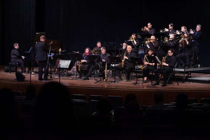
Springtime Jazz with NMC
Award-winning vibraphonist Jim Cooper has been playing the vibraphone for over 45 years and has performed with jazz artist... Read More >>
Dark Skies and Bright Stars
You may know Emmet County is home to Headlands International Dark Sky Park, where uninterrupted Lake Michigan shoreline is... Read More >>
Community Impact Market
No need to drive through the orange barrels this weekend: Many of your favorite businesses from Traverse City’s majo... Read More >>